Adult Vegas Addendum

After the kiddos flew out we still had a full 24 hours with Uncle Dan before he headed back to West Virginia. What to do with three adults in Las Vegas???…….

We didn’t realize until pretty late in the game that Uncle Dan flew out a day after the kids did so there wasn’t a lot of time to plan. So we three headed to the Vegas strip a bit before noon to walk and be “tourists” before Dan had to be at the airport for his red eye later that night.  That gave us about 8 hours to wander. I say “tourists” in quote because Uncle Dan actually lived in Las Vegas for a bit about 15 years ago. And you know when you live in a tourist spot you usually never do the touristy things…

Michael drove the three of us, in the ginormous dually, to Planet Hollywood. I chose it because it’s centrally located to where we wanted to be so I thought it was just as good as any. But sat-nav Janet brought him to the front door of the hotel of which we were not staying. I jumped out and asked where we could park to shop and sightsee for the day. The valet wrote down a phone number for me and that’s where our 007 morning began.

Ooookaaaay…. I got back in the truck to questioning faces. I told Mike to drive, but slowly, as I dialed. I explained we were an oversized truck that needed to park.

Mystery phone man: Where are you?
Me: We just left Planet Hollywood main entrance parking. (As we’re creeping along, under the hotel, following the drive to the left, as originally instructed.)
Mystery phone man: What are you driving?
Me: Black Ram dually with Texas plates.
Mystery phone man: Ok, stop. I see you.
Me: What?
Mystery phone man: STOP! Right where you are. I see you.
Me: Mike, he says stop. Yes, right here. (in the middle of the drive) I don’t know. Hold on.
Mystery phone man: Go ahead and drive, veer right and take a right at the stop sign and wait for me at the gate.

I’m sitting on the edge of my seat looking through the front dash for the wizard behind the green curtain. Seriously! Then it hit me, Duh. We’re in Vegas. There are cameras EVERYWHERE!

So we followed his directions and he’s right behind us in a golf cart. He gets out and unlocks a padlock (pretty low tech way to open a gate with all the other James Bond equipment, if you ask me.) and lets us through. This is where oversized vehicles get to park. For free. Sweet! All we have to do its call him back when we’re leaving to let us back out.

We headed into the Magnificent Mile of shopping to get our bearings and that’s when I spotted Club Tattoo. I already have a few tiny tattoos. I’ve been wanting another one, a compass rose, for about 4-5 years now but couldn’t figure where I wanted to put it. And of course, I’m not going to get a tattoo if I can’t figure out where to put it. But just for giggles I went in and started talking to one of the artists, Ben, just to see what he thought about my plight. I knew exactly what I wanted. I’ve wanted it for a very long time, it’s not like I’ve been hemming and hawing as to whether or not I should get it. And I already have three tats that I absolutely do not regret at all, even after 20 years. It’s just a matter of placement. And then Ben suggested then inside bicep, a place I’d never considered.

Michael, Dan and I walked around a bit and then I decided that was it. I was sold. I went back and got a tattoo on a Sunday morning in Las Vegas, because, hey, why not?

20150425_185932

Cool business card, eh?

20150425_185707

After that the three of us hit the strip!

We got an adult beverage, because we could, and literally walked up and down the strip just checking it out. There is some fantastic people watching, even during the day!! We had lunch at Joe’s Seafood and kept on walkin’!

Party animals we’re not. But we had a good time. And got Dan to his plane on time!!!

Grand, Towering Sequoias… and no photos of them….

We spent a few days dry camping at Pioneer Point campground at Lake Isabella, CA at the bottom tip of Sequoia National Forest finishing up some work reports. We wanted to be close to the park so when we did finish with work we could head up in the hills and sightsee for a night then head back to civilization before prepping a few days before our big trade show in Anaheim. We would have LOVED to have sat in the forest, writing our reports under the canopy of the giant sequoias, but alas, there is no cell service deep in the park and we had lots to accomplish before a mini-break!

I scoped out a route and researched all the campgrounds. Most on the route to the Trail of 100 Giants don’t even open until Memorial Day weekend. But I found one waaaay up north that was open year-round. I circled it on the now-known-to-be-terribly-inaccurate National Park Campground map we were given at Pioneer Point (another year-round open campground) and we headed out to dump our tanks, refill will water, food and fuel. We were good to dry camp another 3-4 days, if needed.

We headed north further into the canyon, following the Kern River that would eventually take us to the Giant Sequoias. The road was steep, twisting, turning, hugging the side of the mountain, as we climbed in elevation. Take note – Lake Isabella elevation is 2513. The vistas were breathtaking. Literally. There were no guardrails. NO GUARDRAILS. Not even rocks placed at the edge! We were climbing hugging the mountainside, which I immensely prefered, but Michael said he would have liked to have been on the other side of the road. When hugging the mountain, rock protuberances hung out high above our heads, sometimes over the white line. No problem if we were in a sedan. But Mike had to swing wide in those instances and  we had to keep an eagle eye to be sure we didn’t scrape the side of the camper! And around those tight curves? Luckily there was very little traffic since he had to spend a lot of time in the oncoming lane.

Neither of us had ever seen a giant sequoia. I had read about them a few weeks ago – the Redwoods and Giant Sequoias are two different trees. Both are “giant” type trees. The sequoias are found in the lower half of California and are smaller than the redwoods found in northern CA. We had to drive quite a ways before we started to see any tree that was unusual to either of us. We had long lost our cell signal so I had no way to research while in the car. And I had not remembered to look any of the info back up before we left to refresh my memory. We were on our own!

Let me remind you we are hauling a 39 foot, 16,000 pound fifth wheel camper behind a Ram 3500 dually. That truck is a BEAST! She drug that camper around those West Virginia-like hairpin turns at 5-10% grades with ease. But these were no ordinary east coast hairpin turns. I grew up driving through WV backcountry and what we drove through in the Sequoia National Forest – all I can say is WOW! Can you see the tiny road on the ridge? That was us climbing….

Kern Rive google map

Finally we started to spot these reddish barked trees. Not so large at first, but we had never seen anything similar before. Then the trunks started to get bigger and bigger. I had to keep reminding Michael to keep his eyes on the road! Luckily by this time we were in forest and not hanging off the side of a cliff! They were pretty giant! But we both concurred not as enormous as we anticipated.

We finally got to Trail of 100 Giants, which I thought was just a scenic road. (Misinformed by the useless National Forest map.) Apparently there is an actual trail. We decided we’d get to our campsite, which we estimated was another 30-40 minutes ahead of us, drop the camper and come back later that day or in the morning. So we kept driving. And climbing and twisting and turning. We reached our peak elevation at 7200 feet.

And then we started down.

6000 feet. Same twisting, winding, switchbacks but now with 16,000 pounds pushing on the truck. We have trailer-brakes and a jake brake on the truck. But we were going so slow the jake brake wouldn’t engage. So Mike was on the brake pedal a lot. I dare you to open up the map below and really look at how squiggly that yellow line is. That is the road Michael was driving down. At a serious grade.

Camp Nelson google map

We hit 5000 feet.

We pulled over at a turnout and took a nap for about an hour (aka, let the smoking truck brakes cool down). I kept looking at my map. Where was this campground? All the other national park campgrounds were so well marked. Why hadn’t we seen this one? Maybe we just hadn’t hit it yet.

So we kept driving. Going down. We’d stop so I could take a picture now and then and give the brakes a rest. It didn’t help that at this particular junction it did not help my nerves that the dash now told us our trailer brakes had disconnected.

We stopped, I checked the connection. Pulled the plug out, plugged it back in. Nope, still not reading. No wait, yes it is! No, no, it’s not. Seems we have a short. Great timing!! As were were driving Mike could hold the trailer brake tester on the dash to engage those brakes before stepping on the truck brake. Folks, we were going about 20 miles per hour. This was some intense driving.

So as Mike focused on driving these steep, winding hairpin turns while trying to save as much of the brakes as possible, I’m trying to spot any traffic coming in the opposite direction from afar and call it out and trying to figure out wherein the hell this campsite is….. (remember, no cell service. can’t just pull up the site and check directions.)

4000 feet, 3000 feet, 2000 feet…. and we were out of the park.

Folks we just climbed up 4,700 feet and back down 5000 feet in one day. We never did find that frickin’ campsite. Obviously we needed to turn off on a road somewhere that I didn’t make a note of. So we kept driving. We ended up camping at Tule on Lake Success, unfortunately not looking very successful at the moment. It too, appears to be a victim of the four-year Californian drought. But the campground if flat with electric and water hook up and a dump site before we head out.

And since we never got to our original campsite we definitely do not have it in us to drive all the way back through that to walk the Trail of 100 Giants. And that, folks, is why I have no pictures of giant sequoias. But I will regale you instead with some other photos I took along the route, including secluded meadows, waterfalls and scenic vistas, the last photo, taken at Lake Success, outside of the park, where we end up spending the night.

IMG_1672

IMG_1683

IMG_1689

IMG_1692

IMG_1717

IMG_1723

IMG_1730

VEGAS BABY!! … with teenagers….

Our trip was quickly wrapping up. I’ll be honest. I had mixed feelings. We had a great time with the kids and Uncle Dan!! But it’s a delicate waltz living with one person full-time in a camper. This pounding Celtic jig the five of us had been doing around each other in our small space for the past week was starting to wear on me. Not to mention, the jig was being stomped out in fine terra cotta-colored dust and sand that was coating every inside surface. I’m no neat freak but this was unbelieveable!

After reviewing our route we decided to boondock it another night on the way back to Las Vegas so we wouldn’t be in such a hurry. But that left me scuttling in the truck looking for a place to stay. This time we wanted something to do – not just a pull over for the night. My trusty atlas outlined the Valley of Fire State Park right across the edge of the Nevada border. It was a first-come, first-serve campground so we hoofed it there as fast as we could.

When you full-time you get all kinds of experiences. But the best ones are the ones you never expect or don’t plan. And this was one of those times.

This park was hidden away. We kept driving and driving, wondering why it was called the “valley of fire”. And almost as we turned a corner we saw it – out in the middle of nowhere these gigantic red rocks burst from the ground! Huge, jagged forms EVERYWHERE! and RED! And you could CLIMB on them!!

JACKPOT!

IMG_1500LR

Remember how I said this group likes to climb rocks? Did I mention Indy, my dog, is a natural rock climber, too?!

IMG_1522LR

IMG_1510LR

IMG_1533LR

IMG_1571LR

Do you see them ↑ ? Waaaay, waaay up at the tippy top? That would be Michael, Z, Uncle Dan and Indy….

And of course, we can’t forget “S Doing Scorpions in Scenic Places: A Collection, Valley of Fire State Park, NV”

Valley of FIre SP UT

That night we all sat outside looking at the stars. The sky was so clear that far out and away from city lights. If you have never had the privilege of viewing stars out in the country you need to make it a top priority. There is nothing that will remind you how small and insignificant you really are in the scheme of the universe. It was this deep thinking that had all of us sitting out in camp chairs, looking up at the night sky, contemplating the cosmos that night. Uncle Dan summed it up nicely when he acutely observed, “Looking at so many stars makes you realize that you’re only just a tick, on a tick, on a tick, on a tick on an elephant’s butt.”

The next morning before we left we headed further into the park and saw Rainbow Vista. Any guesses as to why they call it that?

IMG_1592LR

IMG_1600LR

And I realized if I flip the screen on my fancy pants camera I can take really high resolution selfies too!

IMG_1602LR

We were sad to leave and marked this in our campsite journal as a place to DEFINITELY return!! One night just didn’t cut it. But we had to get back to Vegas because we had a show to see!!

Friday night we all hit the town to see Zarkana by Cirque du Soleil at Aria!! I think Z and I were the most excited of the bunch. Neither of us had seen a Cirque show before and I know I was really looking forward to it! Before we hit the show we hit, none other than, a buffet!! It’s Vegas! You  must eat at least once at a buffet!

Now I scoured the buffet lists and I found several that ignited my culinary flame! But alas, they were usually $40+ per person. And Michael was paying for 4 of us. Let’s face it, a picky 13 year-old and a 16 year-old are NOT going to appreciate these particular choices. So I went looking for one that was cheap and close to Aria. That left The Buffet at Excalibur.

I am a foodie. I love gourmet food and home cookin’ alike. But when you go to The Buffet you are getting what you pay for. At $26/ person (it was a little more that night because it was ‘seafood’ night), it’s food is ‘eh’, but satisfying. You aren’t going to get food poisoning. (at least none of us did) But I didn’t find anything outstanding there. Let’s say, for me, it was uneventful.

However, for everyone else, it was a HIT! Z got to try “sushi” and he LOVED it! (None of it contained raw fish. They had cucumber rolls and something filled with an overly-mayonnaised fake crab. But he didn’t know the difference and was delighted.) Since it was seafood night they had boil and peel shrimp, skinny crab legs, mussels and a few seafood-inspired dishes. And S, who claims to detest seafood, loved the buffet because she could pick at her salad, mashed potatoes and gravy and then the dessert bar and no one would yell at her for not eating anything. (Even though her father forked over $26 for this privilege.)

So maybe The Buffet didn’t hit my snooty food mark but it won in everyone else’s book. According to Z it was “the best meal he ever had!” (mumbled with food in his mouth as he continued to shove it in by the forkfull.) So I’ll count it as an overall win.

Zarkana. It. Was. Amazing. If you’re in Vegas, go see it.

And the last, current, installment of “S Doing Scorpions in Scenic Places: A Collection, The Las Vegas Strip.”

Vegas Strip

The next, and final day, consisted of going to a water park in Vegas. The kids got to don bathing suits before hitting the plane later that night back to cold Syracuse. We thought this would be a great idea since temperatures were to hit in the 80’s that day. Well… it wasn’t exactly as we had expected. The temps reached the high 70’s. But it hadn’t been consistently hot enough to really warm up the water. It was FREEZING! I hit a few slides than called it quits. Michael and Dan hit a few more than me. Other than that we let the kids play until closing.

We put the tuckered out kids on a plane that night and let them sleep the night home, all the way back to New York. It was a great trip! And now, almost 2 weeks later, I still don’t have this camper completed rid of red dust and sand. But that’s ok. It was worth it!

Utah is……

I know, I know. I’m kinda dragging out this whole vacation posting thing. And S, if you’re reading, I know, there’s not enough about you in it. 🙂 But the thing is, I have real work to get caught up on, RV packing up and moving to do, campsites to immediately find, pictures to go through… on top of that I’m also trying to reach back a week or so and even remember what the heck we did. Yes, there were funny moments – none of which I feel I’m capturing here. (yet, anyway). But I really want to make sure I, at minimum, get down what we did and where for posterity. Along with the photos, of course.

The lesson learned: Blog while you’re vacationing. Even if you can’t post it you can write it. Then it doesn’t turn into such a chore when you get back. And you really do capture the funny stuff to share!

After our night in the secluded beauty of the rainbow rocks, we continued to our next destination, Escalante Petrified Forest State Park in Escalante, Utah. I had booked us a few nights at the state park that sits inside the Grand Staircase-Escalante National Monument. Let me be honest – I had no idea what this park was about. Several months ago, when we decided on this vacation, I sat down and started combing state and federal parks for a site that a) was available and b) could fit our rig. A 39′ fifth wheel is no small camper. Campground after campground was coming up booked (it was spring break, after all) or could not accommodate a camper our size. When this park had an opening I snagged it. I figured we were close enough to other parks that the worst situation was that we’d drive everyday to a park and just use the campground as a base camp.

Man did we luck out!

It’s called the Petrified Forest state park for a reason! DUH! First there were rocks and boulders EVERYWHERE! And what did I say keeps a Boadway happy? Climbing on rocks and boulders!! Second there was a fantastic path up the side of the hill through an area covered in petrified wood! I had no idea it would be so colorful!

IMG_1221LR

IMG_1236LR

IMG_1219

And the scenery was breathtaking.

IMG_1250

IMG_1259LR

That’s how we spent one morning. That afternoon we headed to Calf Creek to hike the three miles, one way, to the Lower Falls. It was just a 10 mile drive east of our park. The drive itself was indescribable. Marbled canyon walls, steep, hairpin turns. Unfortunately not enough great places to pull the big dually over to take photos. There’s the Kiva Koffee House between our camp and the falls on Hwy 12 that sits atop a hill, surrounded by all of this gorgeousness. It has wraparound windows for an unobstructed view. However we went to falls on a Tuesday – the day the Koffee House is closed. I have no idea what their coffee is like but I’m certain you need to stop for the phenomenal views!

At Calf Creek we meandered the three miles to the falls. Interestingly, a lot of the trail is sandy. Sand so fine, in fact, it’s like powdered sugar the color of terra cotta! Sounds neat. Crap to hike in. But still a hike that it worth it!

IMG_1366LR

IMG_1380LR

There were ancient pictographs too!!

IMG_1328LR

And getting close to the falls…

IMG_1341LR

And the falls!!!

IMG_1353LR

IMG_1354LR

And more in the “S Doing Scorpions in Scenic Places: A Collection”

IMG_1363

That was enough excitement for one day! I think we all slept like the dead that night. Which was a good thing because I had it on good authority that Bryce Canyon is waaaay better than Zion National Park. Convenient – since we were a lot closer to Bryce Canyon anyway.

That is, of course, so long as it’s not’s SNOWING!!!

Yes folks, the kids that left Syracuse, New York to get out of snow woke up to light flurries. Oops! Although no one was in the mood to hike in it, it made for some great pictures. That’s after the mad raid for warm clothes through MY closet. S was swaddled head-to-toe in my oversized long sleeve performance shirts, fleeces and jackets. Z was in my Adidas workout pants, flood waders for him, and my Clemson sweatshirt. (because you know, 16 year old boys are too cool to be too warm and cozy, but humble enough to wear ridiculous looking highwater athletic pants.) And Uncle Dan had on a pair of my funky designed spandex running tights under his shorts. Michael swears he will never look at me the same way in those (previously sexy) running tights again. :-/

We may have driven through Bryce Canyon but I took some pictures (and on the way there!!)

We pulled over the side of the road to capture this snow system moving across the distance!

IMG_1404LR

Bryce Canyon in snow.

IMG_1407LR

IMG_1416LR

IMG_1424LR

IMG_1432LR

Another long day and we were pooped. We needed our rest because we were headed back to Nevada and Las Vegas, baby!!

Scenic Byways in AZ

We left the Grand Canyon and headed north. Our next destination was the Grand Staircase – Escalante National Monument in Utah. Our route took us north on Hwy 89 to Page, AZ and over to Kanab, UT to carry us on to our destination. But while in the truck I noticed a Hwy 89A that split at Bitter Springs, AZ  that skirted the south edge of the Vermillion Cliffs National Monument and a “red dot” labeled “Navajo Bridge” and on to Fredonia where it soon met back up with regular ‘ol Hwy 89 in Kanab.

I know in this day and age of wildly popular electronics and gadgets it seems ridiculous to read anything “paper” while navigating but any RVer worth his/her salt will tell you it’s a must. I will admit to not carrying any maps. I leave that to the GPS in the dash and our phones. I do, however, have an American Highway road atlas I picked up at a gas station a while back. It claims “140 detailed road maps and 55 large city maps and a national parks section with profiles of the top 12 parks.” I bought this a few years ago before I was even considering RVing. It appears to have been published in MMXIII. (2013. I had to look it up too….) This comes in handy ALL THE TIME!

  • double check Janet (what we lovingly call our in-dash sat-nav)
  • get my general bearings
  • planning
  • illustrate to Michael when a cell phone screen is just too small

You may be asking yourself, “what in the heck is a ‘red dot’ “? It’s just my atlas’ way of noting points of interest. So I started investigating this Navajo Bridge and decided it fell perfectly into a “Dillon Vacation Detour”. So we took it.

But before we even got that far we saw signs for “Sunset Crater Volcano National Monument“. We actually saw signs for this on the road, and turns out, it’s POI in my map too! We had no idea what it was or what to expect, but hey! That’s how a “Dillon Vacation” goes! *wink*wink*

It was most interesting volcanic rubble! We were able to hike around in it and take photos!! You let the Boadway’s climb on rocks and they are happy!!!

IMG_0761

IMG_0743LR

IMG_0776

I want to note here that I made the $80 “investment” of an Annual National Parks Pass while at the Grand Canyon.  Hey, it’s only a $10 lifetime pass if you’re over 62! By the end of the vacation it had already paid for itself. I highly recommend it since it gives you free access to all the national parks. They can get kind of expensive….. $25/ car here, $5/ car there… it adds up! This really is the cheap way to see them time and again throughout the year!

Highway 89A did not disappoint! It is an official scenic byway. We even stopped at a marked area of ancient pueblos!

IMG_0820

And we made it to the Navajo Bridge! (ok, I have since figured out how to get the exposure correct when I have light and shadow in my view. I did not know how to do that then… Please excuse my learning curve….)

IMG_0959

IMG_0967

Trying to stay free and easy, I had left one night open for us to boondock. See! I do have a wild side!! If I haven’t mentioned it before I use www.overnightrvparking.com.  It’s a subscription site on where you can stay overnight, usually for free. There are other free sites but I like this one because other RVers submit info to “keep it real”.  I found we could just pull over on the side of the road on a gravel pull out on 89A. So we did.

Sometimes you get a stinker. And sometimes you hit the jackpot!

IMG_0916

IMG_0942

This was our backyard in  Vermillion Cliffs!!

IMG_1027

20150405_182331

The next morning… on to UTAH!!!!!

Spring break adventure… with teens…

You may recall a while back I lamented on the difficulty of posting regularly while on the road. You may also notice it’s been about two weeks since my last post. Yep, there’s a reason for that.

Like most of the US, especially those with children, we have been on Spring Break. And our SB involved:

  • a 13 year old
  • a 16 year old
  • retired Uncle Dan
  • some of the most beautiful places in America
  • spotty, if any, cell service

Anyone in this day and age might read “13yo, 16yo and no cell service” and gasp in horror at what terrible stories lie ahead. There are stories to be told, and for your bladder and eye comfort, not all in one post. But I will say we all survived no worse for the wear after this extended holiday. I’ll be the first to admit my utter surprise that we all appear to have remained sane. Me, most of all. (but just barely)

Some background: Michael has three kids. T, the oldest, is in college and is past “family holidays”, much to her dad’s chagrin. Spring break is a little easier to understand since colleges don’t have the same break schedule. Z is 16 and a sophomore and S is a 13 year old 7th grader. These ages are hard to juggle vacations too but more because you’re vying for time against school activities, after-school activities and the dreaded “social circle of teenager friends”. Because we all know, there is absolutely NOTHING cooler than your teen’s BFFs, am I right?

And if you’re an amazing enough parent that your kids want to spent time with you , you still have to be in constant competition with the current Wi-Fi enabled communication device. What if there’s a text from their bestie?!?!  And, seriously folks, where was streaming music when I was a kid? Yes, I had a walkman and then a discman, but I could never get that volume loud enough to drown out the books-on-tape my mother insisted on renting from the library before we went on a cross country car trip!

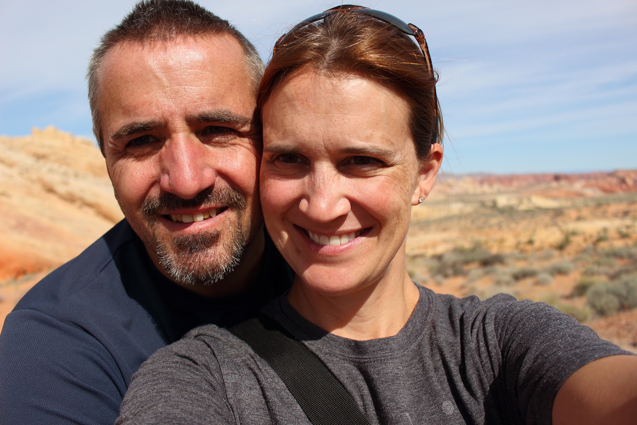
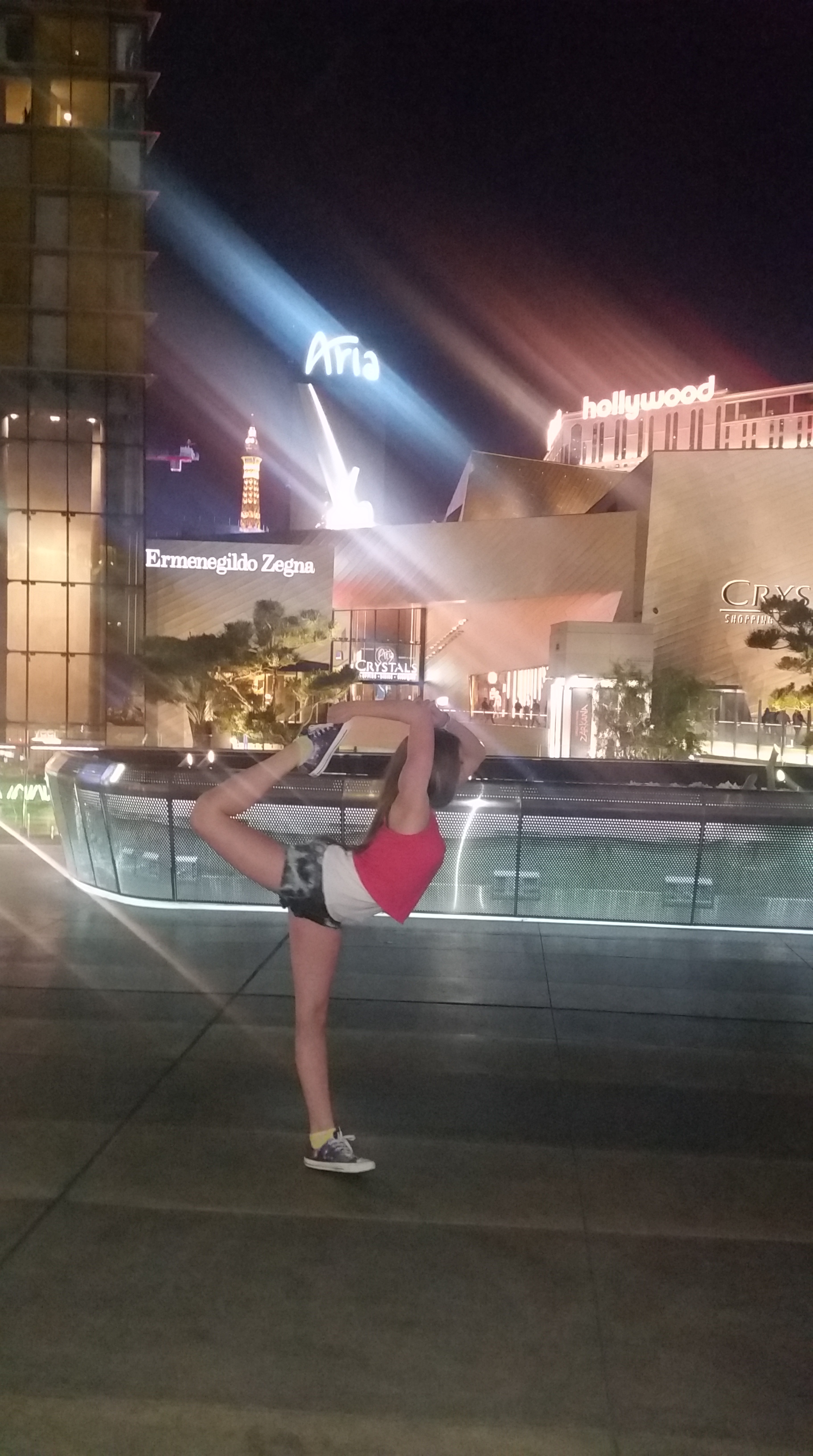
And I can’t forget Uncle Dan. Mike’s brother is barely 50 and already retired. You think we’re living the life?!?! Uncle Dan lives in WV. The kids flew in from Syracuse, so everyone was excited to get out of cold weather. We started our grand adventure with everyone flying into Las Vegas, because what else would get you the side eye when you say you’re taking your teenagers to Vegas?

I was the self appointed tour guide for the trip. I had very mixed feelings about this title. Michael didn’t ask me to plan the trip at all. But his idea of trip planning is “winging it” and hope for the best. I’m the exact opposite. Since we’ve started full-timing I’ve had to loosen up a bit. (for me it’s felt like a lot!) But I refused to have 3 people show up and not have a flippin’ idea of what was going to happen. I wanted them to have a nice trip. And I didn’t want to become unhinged. (to put it mildly)

I didn’t take this responsibility lightly. I pondered and complemplated and speculated for weeks about what kind of activities would really “make” a vacation for this group of people. That’s a tough order. At least I thought it was. Luckily they all like to hike. I finally realized, what better vacation than to show them the “fun” vacations my family took when I was growing up? None of them had similar experiences and it would include all the types of activities Michael and I would like to show them.

So I decided to plan a traditional “Dillon Vacation”! The only real difference – my family did it in a car or minivan with camping gear in the back. This group was lucky enough to do it in the luxury of a 5th wheel camper and Wi-Fi! (sometimes..) My dad was a teacher so we were fortunate enough to hit the road for weeks at a time in the summer, just road-trippin’ and seein’ the sights! Tourist trap, anyone? And like any vacation with sight seeing on the agenda, the trick is how-much-can-you-jam-into-12-days??

FIRST STOP – THE GRAND CANYON NATIONAL PARK

Everyone knows this is a default on “The Bucket List”. None of us, except Dan, had ever been there. So as not to try and over-plan our trip I generally made campsite reservations and looked up possible things to do in each area. Then once we got there we could take a consensus, see what people were interested in, see if there was anything the locals or guides suggested. You know, roll with it. (This is about as “winging it” as I feel comfortable. Especially since many campsites were completely booked solid months ago since it was a holiday week.)

We really only had a few days in Williams, AZ, a cute little Route 66 town. And yes, I made Mike drive part of the way from Las Vegas to Williams on the historic Route 66. Scenic drive!! Ok, not as much as I had hoped. But I felt compelled to give a quick history lesson about Rt. 66 and what is was, etc.

And that’s when it hit.

Oh My God!

I’ve turned into my mother!!! (insert Psycho movie music here.)

Because every vacation had to include an educational element. And it was tailored to your age. Because my brother is 11 years younger than me. And sometimes my little cousins would come with us. So everyone had a learning syllabus geared towards his or her age, interests and abilities that ran parallel to the vacation stops. Case in point: One year while in the Northeast we had to stop at Walden Pond. I was in high school so I had reading assignments by Thoreau. My little cousins got to gather sticks and hot glue gun them onto picture frames. Clearly they were in elementary school. The oldest, Brian, then about 10, now a lawyer, probably had to identify some plants while doing this. But I digress.

So, Route 66. The kids could have cared less. Uncle Dan seemed very interested and always had his own facts to add. Mike? Couldn’t say. He always drives when we’re haulin’. Not interested or just focused on the road? Or maybe just amused by the whole show going on in the rest of the truck? But we did stop at little dive tourist trap on the way – Grand Canyon Caverns. We took the $20/ person tour through the “Largest Dry Caverns in the United States”. Folks, I’ve been to some amazing caverns. I was really excited to see the “largest”. And it was a very interesting tour! Did you know you can actually spend the night – like a hotel – in this cavern?? But what I realized as we were touring is that all the cool stalactites and stalagmites and the really colorful deposits are left in wet caves….  :-/

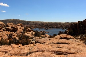
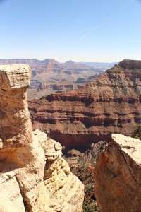
As you may recall I bought a fancy pants new camera. I’m still learning how to use it, let alone take fancy pants artistic pictures with it. But I don’t feel bad about my pictures of the Grand Canyon. I think very few people can truly capture “The Grand Canyon” on film. But I snapped a few. The first day we drove up and just checked things out.

IMG_0461LR

IMG_0450LR

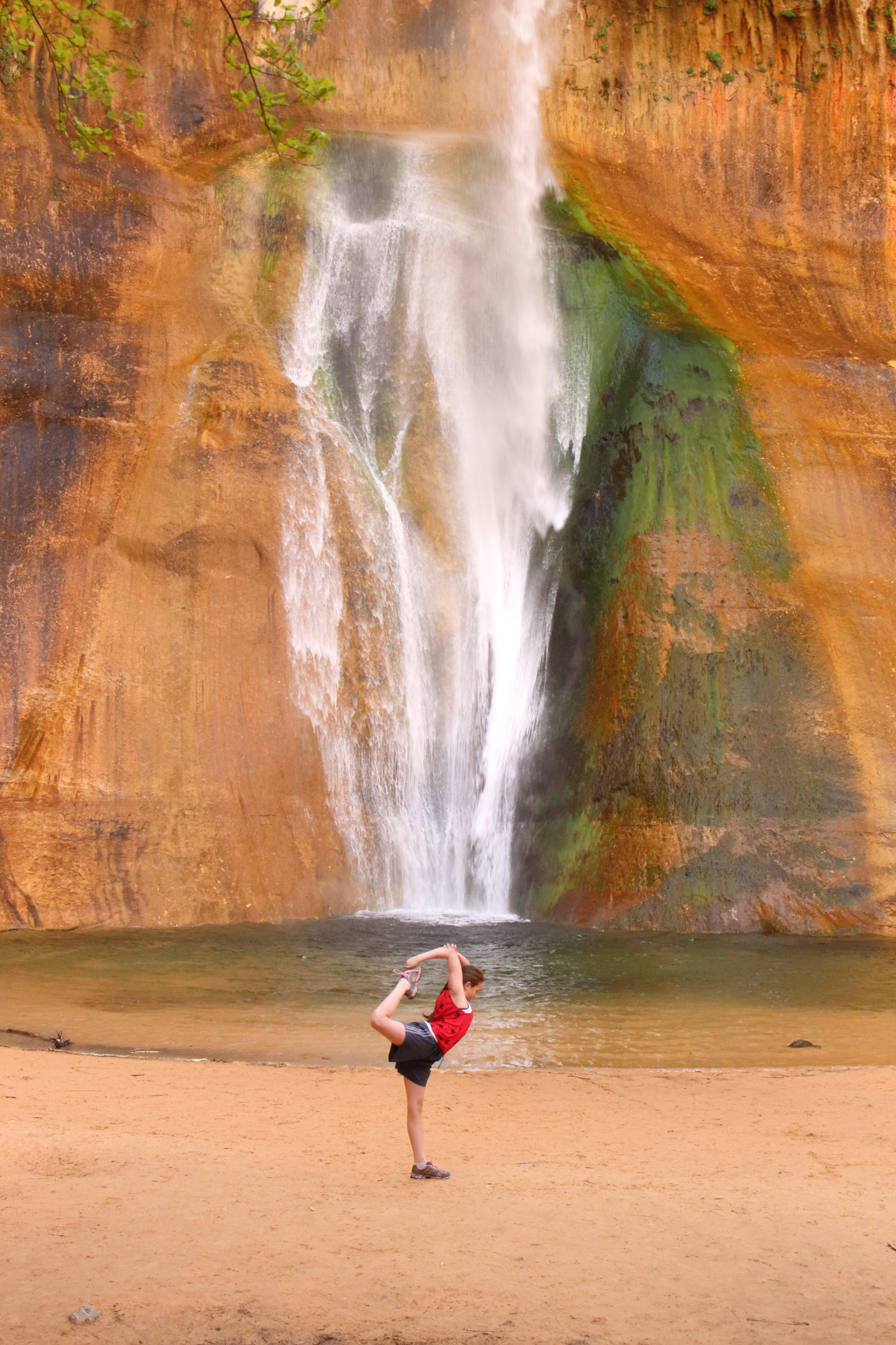
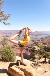
Little did I realize we started a new photos series with S, her doing cheerleading scorpions in scenic places across the US. That is what is interesting to a 13 year old girl.
Grand Canyon

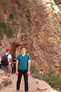
The second day we took the scenic Grand Canyon Railway Train to the canyon instead. Once there we only had a few hours to hike a bit down into the Bright Angel Trail and back before the trail left the station for the 2.5 hour ride back to Williams.

IMG_0592LR

IMG_0607LR

In Williams we stayed at the Canyon Motel & RV Park. It’s a cute, quaint little place where you can stay in a room or in a caboose or railway car!! It looks so neat I almost didn’t want to stay in the RV! THe staff was very helpful with getting our train tickets too. However, as a side note, when management of the RV park tells you to unhook your water line at night because it might freeze… don’t forget to do it the second night because it might break a fitting on their pump. And parks don’t like it when you accidentally break their stuff. Just ask Uncle Dan.

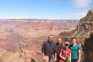
So after all the majestic grandeur of what is known as THE Grand Canyon… no one was very impressed. I’m serious. “too many people”, “paved trails? really??” “It’s crowded”.  It seems as though this particular tour group prefers serious hiking and rock climbing. I think everyone would have enjoyed it more if we’d had more time to really hike down into the canyon, possibly spend 3-4 days packing it in and around. That’s probably too advanced for S, but that’s right up Z’s ally. I have already informed Mike that we have to get my camping/backpacking gear out of storage so we can do the canyon “right” next time!

NEXT STOP – UTAH BY WAY OF VERMILLION CLIFFS IN ARIZONA

Prescott’s Granite Dells

I was able to research these strange, captivating rock formations found here in Prescott and the surrounding area. They are called Granite Dells and were formed from erosion over the past 1.4 billion years! The unusual shape is caused by “spheroidal weathering” and the Dells are high in uranium. Houses built here have to closely watch radon levels coming from the rocks!

Interesting!

IMG_0277LR

IMG_0289LR